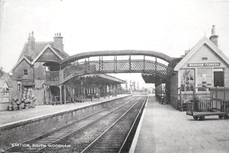
The railway station built by the Great Eastern Railway in 1889 at the junction between the Southminster and Maldon branch lines lies about a mile away from the village of Woodham Ferrers from which the station took its name. The new station buildings together with six workers’ cottages established the first nucleus of buildings in what was essentially a ‘greenfield’ site which in due course became South Woodham Ferrers but then was a thinly populated agricultural area occupied by a few farms.
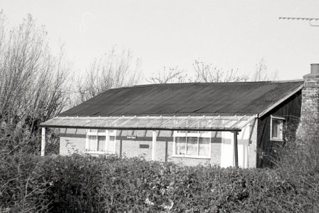
The locality, with rather poor soils, had been badly hit by the widespread agricultural depression in Britain in the second half of the 19th century and in common with many similar areas in south-east England the railway provided the catalyst for a form of growth in South Woodham Ferrers which became known as ‘plotland’ development - the subdivision of uneconomic agricultural land into plots and their sale for development. The area’s two main farms Champions and Eyotts, which together make up most of today’s town, were laid out with a grid-iron pattern of roads with hundreds of plots of land offered for sale in the decade after 1895. The ‘roads’ were sometimes no more than plough lines across fields but the availability of cheap land and the possibility of a new home in the country were attractions that drew people to the area. Sales literature was particularly aimed at those wishing to leave overcrowded conditions in London and special excursion trains brought potential buyers to auctions in the area with the incentives of free luncheons, free conveyances and easy repayment terms. The sales led to a haphazard growth of largely self-built bungalows, houses, smallholdings and nurseries, with the waterside locations provided by two tidal creeks proving especially popular for weekend cottages. Prior to the 1914-18 war the area could also boast a number of small shops, an hotel and two church mission halls.
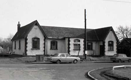
Although the initial take up of land was slow, probably because of the multiplicity of rival schemes being promoted in Kent and south Essex, the inter-war years were to witness an upsurge of interest in the area, including the involvement of a number of small building companies, and by the end of the 1930s the growing village could boast a school, a ‘Smallholders’ Hall’ built by community effort, three more churches and a Women’s Institute hall. Development was concentrated in Hullbridge Road which became the main road. Market gardening and poultry farming were common businesses in this inter-war period.
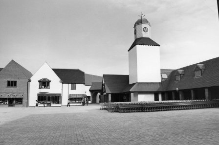
In post-war years there was no major change in the general pattern of piecemeal development and by 1960 the population had only reached about 900. However in the following decade the village underwent a marked change in character and a fourfold increase in population when private housing estates began to be built around the railway station. These new estates though were just a prelude to a scheme initiated by Essex County Council in 1972 to develop the area into a ‘New Riverside Country Town’. This development, through compulsory purchase orders, swept away all the old ‘plotland’ buildings still scattered along the outlying unmade roads of the village and laid out a new network of roads serving new schools, a distinctive new central shopping area, employment areas and with housing areas based on the design and layout principles embodied in the County Council’s pioneering ‘Design Guide for Residential Areas’: today’s town with a population of some 18,000 is the result.
ILLUSTRATIONS:
An inter-war view of the railway station that opened in 1889
A ‘plotland’ building ‘Sans Souci’ (‘without cares’) a name embodying the idea of freedom that the ‘plotland’ estates engendered,
The Smallholders Hall prior to demolition in 1973
The new town centre in about 1979


